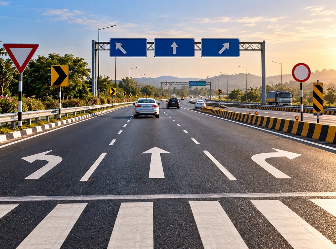
Road markings and traffic signs are essential components of highway infrastructure. They communicate lane boundaries, movement restrictions, road hazards, route directions and speed limits to drivers. On high-speed roads, this information must be clear enough to understand without requiring sudden braking or changes in direction. In India, highway signs and pavement markings are provided in accordance with applicable Indian Roads Congress (IRC) codes and Ministry of Road Transport and Highways (MoRTH) specifications. Understanding these markings and signs helps drivers interpret road conditions, make timely decisions and contribute to safer traffic movement, supporting the broader objective of highway road safety. Understanding how highway traffic signs in India work alongside pavement markings also helps drivers respond correctly to changing road conditions.
1. Broken and Continuous Lane Lines
Broken and continuous lane lines regulate how vehicles move between lanes. Broken lines generally indicate that a lane change may be permitted when the movement is safe and complies with traffic rules. Continuous lines impose restrictions on crossing, depending on the marking and road layout. On multilane highways, these lines help drivers maintain their position and avoid unnecessary lane changes. Their condition is particularly important near interchanges, merging lanes and sections with limited visibility. Drivers should check surrounding traffic before changing lanes and must not cross continuous lines where doing so is prohibited. Maintaining lane discipline through these markings is an important part of highway road safety.
2. Centre Lines and Double-Line Markings
Centre lines separate opposing traffic streams on roads without a physical median. Depending on the marking configuration, they indicate whether crossing the centre line is permitted. Double continuous lines impose restrictions on crossing and are particularly important where overtaking could expose vehicles to oncoming traffic. A combination of continuous and broken lines communicates different crossing permissions to traffic approaching from either side. These markings are used with consideration for sight distance, road geometry and traffic conditions. Drivers should follow the line applicable to their direction of travel rather than assume that every centre line permits overtaking. Correctly interpreting these road markings and traffic signs helps drivers understand where crossing or overtaking is restricted.
3. Edge Lines
Edge lines mark the boundary of the travelled carriageway and distinguish it from the adjoining shoulder or road area. They provide a visual reference on curves, narrow road sections and stretches where the pavement edge may be difficult to identify. On highways with limited street lighting, edge lines become particularly useful after dark. They can also help drivers maintain their position during rain or reduced visibility, provided the markings remain visible. Edge lines do not indicate that a shoulder is suitable for ordinary driving or stopping. Drivers must follow the applicable restrictions and remain alert to obstacles near the carriageway. Maintaining visible edge lines contributes to highway road safety, particularly on poorly lit stretches.
4. Directional Arrows and Lane-Use Markings
Directional arrows painted on the road surface show the permitted or designated movement from a particular lane. Depending on the layout, arrows may indicate straight-ahead travel, turning movements or a combination of directions. These markings are commonly important near intersections, toll plazas, exits and entry ramps, where vehicles must select the correct lane before reaching a decision point. Lane-use markings help reduce confusion between vehicles heading towards different destinations. Drivers should read the arrows early and confirm their route using roadside or overhead signs. Last-minute lane changes can interfere with other traffic and increase collision risk. Consistent road markings and traffic signs provide drivers with clearer guidance when approaching highway junctions.
5. Stop Lines and Give-Way Markings
Stop lines indicate where vehicles must halt when required by a stop sign, traffic signal or applicable traffic rule. Give-way markings identify a point where drivers must yield to traffic that has priority. These markings are especially important at intersections, ramp connections and other locations where traffic streams cross or merge. Stopping beyond a designated line can obstruct pedestrian crossings or place a vehicle directly in the path of conflicting traffic. Drivers approaching these markings should check the relevant signs, signals and traffic conditions. The presence of a clear road ahead does not override a mandatory stopping or yielding requirement.
6. Zebra Crossing Markings
Zebra crossing markings identify designated pedestrian crossing locations. On highway sections passing through urban areas or settlements, they may be found near junctions, bus stops and locations with regular pedestrian movement. The markings alert drivers to the possibility of pedestrians entering or crossing the carriageway. Their effectiveness depends on visibility, suitable placement, adequate sight distance and compliance by road users. Drivers should approach these locations attentively and be prepared to slow down or stop when required. Pedestrian crossings on high-speed roads also need appropriate supporting infrastructure where necessary, because painted markings alone cannot eliminate conflicts between pedestrians and vehicles. Properly designed and maintained crossings are an important consideration in highway road safety.
7. Chevron and Diagonal Hatch Markings
Chevron and diagonal hatch markings identify areas of pavement that vehicles should not ordinarily occupy. They may be used near traffic islands, lane divisions, merging and diverging sections, or other locations where a separation area is required. These markings help distinguish the traffic path from a space intended to separate vehicle movements. Entering a marked exclusion area can interfere with vehicles travelling in adjacent lanes or entering an interchange. Drivers should follow the intended path and avoid using these areas to overtake, bypass queues or make abrupt corrections. The exact restrictions depend on the marking design and applicable traffic rules.
8. Speed Limit Signs
Speed limit signs display the maximum permitted speed for a particular stretch of road or traffic condition. These signs are a key category of highway traffic signs in India, particularly where the permitted speed changes according to the road layout or surrounding activity. Limits may change near built-up areas, junctions, toll facilities, curves, construction zones and other sections where different operating conditions apply. Drivers must observe the applicable posted limit while maintaining a speed appropriate to visibility, traffic, weather and pavement conditions. A maximum speed is not a requirement to travel at that speed in every situation. Temporary restrictions must also be taken seriously when work or an unusual hazard affects the normal road layout. Correctly positioned speed limit signs help drivers anticipate and comply with changes in permitted speed.
9. Mandatory and Regulatory Traffic Signs
Mandatory and regulatory signs communicate legal restrictions and obligations for road users. Examples include no-entry, no-overtaking, compulsory-direction and vehicle-restriction signs. They may govern access to a road, permitted movements or the conduct of particular vehicle categories. Standardised highway traffic signs in India follow established design conventions so that drivers can recognise the type of instruction without relying entirely on written text. Ignoring these signs can result in prohibited movements, conflicts between traffic streams and legal penalties where applicable. Drivers should observe regulatory signs throughout their journey, including on service roads, ramps, interchanges and approaches to toll plazas.
10. Warning Traffic Signs
Warning signs alert drivers to potential hazards or changes in road conditions ahead. Common examples include signs for sharp curves, steep gradients, narrow bridges, road narrowing, intersections, merging traffic and pedestrian activity. These signs provide advance notice so drivers can adjust their speed, position and attention before reaching the affected section. The distance between a warning sign and the hazard should account for the road’s operating conditions and the time needed for a safe response. Drivers should avoid sudden braking or steering at the hazard itself. Warning signs identify potential risks, but they do not replace the need to assess the actual road conditions. Consistency between road markings and traffic signs helps drivers understand the warning and identify the appropriate path ahead.
11. Direction, Destination and Exit Signs
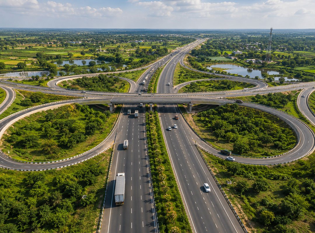
Direction, destination and exit signs help drivers follow a route and identify the correct interchange or connecting road. These form an important category of highway traffic signs in India, particularly on expressways and National Highways where decisions must be made at higher speeds. Advance direction signs provide information before a junction, while exit direction signs identify the route to take at the relevant location. Destination names, route information and arrows must be sufficiently legible for drivers to understand them at highway speeds. Consistent placement also helps motorists distinguish between advance guidance and instructions at an actual exit. Drivers should read these signs early, select the appropriate lane in time and avoid reversing or making unsafe manoeuvres after missing an exit.
12. Route Markers and Kilometre Stones
Route markers and kilometre stones provide information about road identification, location and distance. Route markers help drivers confirm the highway or route they are travelling on, while kilometre stones indicate distance along the road. These features can support navigation, location reporting and identification of the approximate position of an incident or roadside problem. Accurate and legible location information is useful for road maintenance teams and emergency response services. On long highway corridors, consistent route identification and distance markers help motorists verify their progress without depending exclusively on mobile navigation applications. Their placement and information should remain consistent with the applicable highway standards.
13. Road Studs and Delineator Posts
Road studs and delineator posts provide additional guidance where painted markings alone may be difficult to follow. Road studs are installed on or near the pavement surface to help define lane boundaries, curves and road alignment. Delineator posts provide visual references alongside the carriageway, particularly where the alignment changes or the road edge needs clearer definition. Reflective elements can improve visibility when illuminated by vehicle headlamps at night. Their location, spacing and type depend on the road layout and applicable specifications. Damaged, missing or poorly positioned devices can weaken guidance, making routine inspection and replacement important parts of highway maintenance. Proper maintenance of these devices supports highway road safety by preserving visibility along the route.
14. Hazard Markers and Object Markings
Hazard markers identify fixed objects or physical features that require particular attention from approaching drivers. They may be provided near bridge supports, traffic islands, culvert structures, median ends and other roadside or carriageway features. Object markings make these features easier to recognise, especially where their position could create a collision risk. Their purpose differs from that of destination signs because they draw attention to a physical hazard rather than communicate route information. Correct placement, adequate contrast and unobstructed visibility are essential. Drivers should respond to the actual road layout and avoid assuming that a marked hazard is the only obstruction in the area.
15. Temporary Traffic Signs and Road Markings
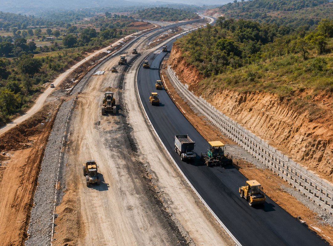
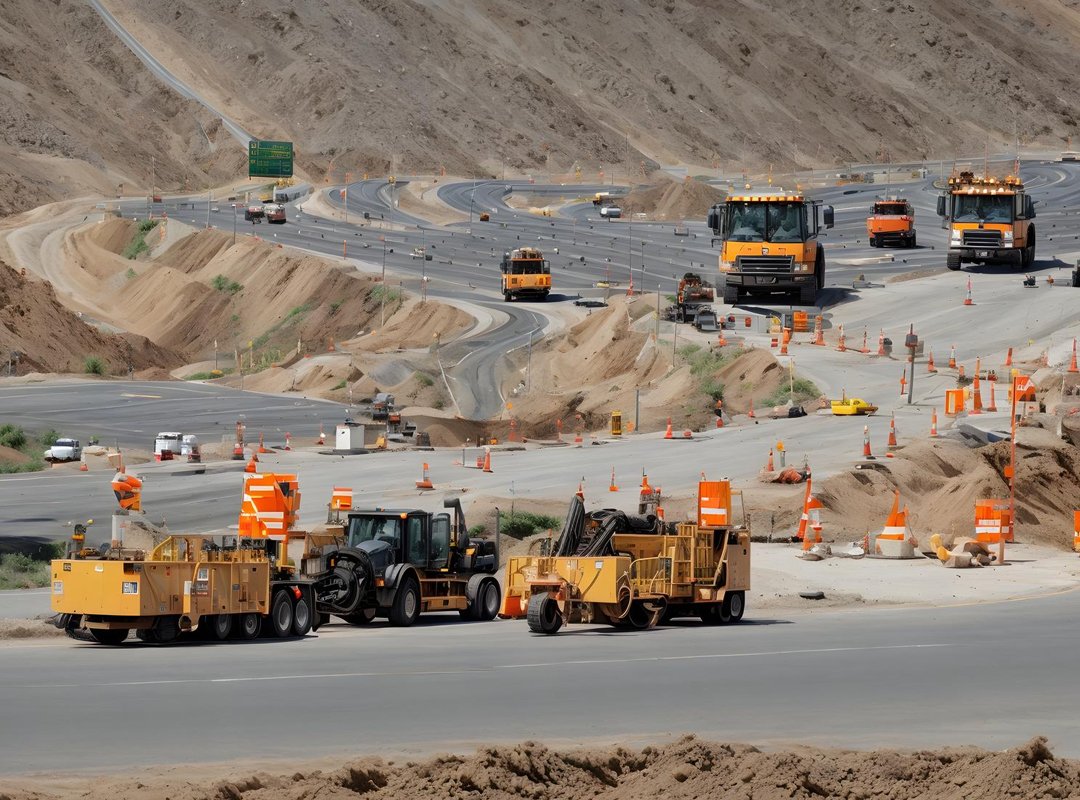
Temporary signs and markings are used during construction, maintenance, resurfacing and other activities that alter normal traffic movement. They may indicate lane closures, diversions, reduced speed limits, temporary lane alignments and restricted access. Cones, barricades and delineators may supplement signs and markings to separate moving traffic from workers and equipment. The temporary layout should be clear and consistent, with conflicting or obsolete markings addressed wherever necessary. Drivers should follow the temporary instructions instead of assuming that the usual lane arrangement continues through the work zone. Clear road markings and traffic signs in work zones are essential for protecting both road users and personnel working on the highway.
Road markings and traffic signs communicate distinct instructions that help drivers navigate highways safely. Lane lines regulate movement, stop lines control vehicle positioning, arrows identify lane directions, and regulatory and warning signs communicate rules and hazards. Route signs, road studs, delineators and hazard markers provide further guidance across different road conditions. Their effectiveness depends on appropriate design, correct placement, visibility and timely maintenance. For highway road safety, these devices must work as a consistent system, supported by drivers who recognise and follow the instructions provided. A clear understanding of highway traffic signs in India, together with correctly interpreted pavement markings, helps drivers make informed decisions throughout their journeys. Pawan Highways India Pvt. Ltd. (PHIPL) is committed to contributing to quality highway infrastructure that supports reliable connectivity, efficient transportation and long-term road safety across India.